von Marco Verch unter Creative-Commons-Lizenz
Luftbild der mittelalterlichen Festung Sant Salvador, Mallorca
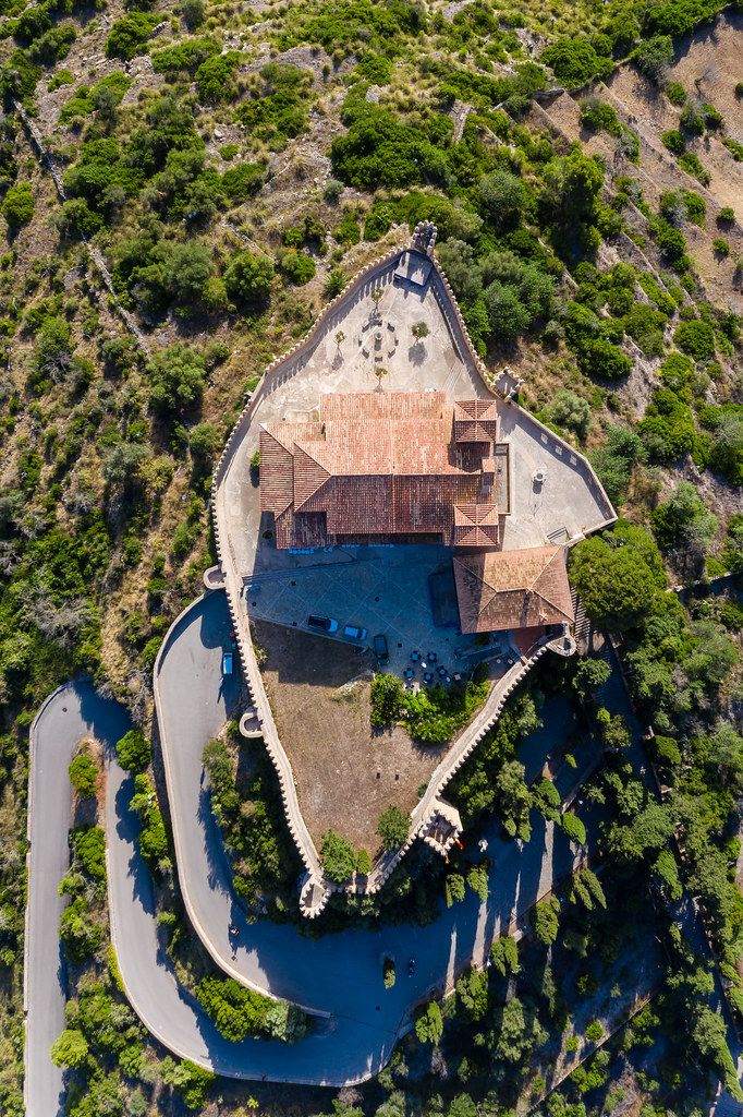
Luftbild der mittelalterlichen Festung Sant Salvador, Mallorca von Marco Verch unter Creative Commons 2.0
Dieses Bild kann bei sichtbarer Nennung von Urheber und Quelle kostenlos verwendet werden. Anfrage für eine Nutzung außerhalb der Lizenz.
Das Bild zeigt eine Luftaufnahme einer beeindruckenden Burg oder Festung, die sich inmitten einer üppigen, grünen Landschaft befindet. Die Gebäude haben ein traditionelles, mittelalterliches Design mit Dächern aus roten Ziegeln und türmenden Strukturen. Die Burg ist von einem See oder Fluss umgeben, der das Gebäude malerisch in Szene setzt. Die Komposition des Bildes ist ausgewogen, mit einem Fokus auf die imposante Burg, die sich vor dem Hintergrund der grünen Hügel und Wälder abhebt.
Dieses hochauflösende Luftbild wäre hervorragend für den Einsatz in Blogs, Newslettern oder Social-Media-Kampagnen geeignet, die sich mit Themen wie Reisen, Geschichte, Architektur oder Landschaftsfotografie beschäftigen. Als kostenloses Stockfoto unter einer Creative-Commons-Lizenz kann es frei heruntergeladen und für verschiedene Zwecke genutzt werden.
Informationen zum Bild und Creative Commons Lizenz
| Original-Titel | Overhead Luftbild der mittelalterlichen Festung vom Santuari de Sant Salvador in Artà, Mallorca |
| Fotograf | Marco Verch |
| Veröffentlicht | 11.08.2020 |
| Lizenz | Creative Commons 2.0 |
| Aufrufe | 10 |
| Downloads | 2 |