von Marco Verch unter Creative-Commons-Lizenz
Luftbild: Platja de Formentor mit klarem Meer
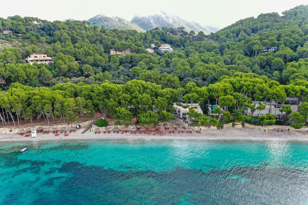
Luftbild: Platja de Formentor mit klarem Meer von Marco Verch unter Creative Commons 2.0
Dieses Bild kann bei sichtbarer Nennung von Urheber und Quelle kostenlos verwendet werden. Anfrage für eine Nutzung außerhalb der Lizenz.
Das Bild zeigt eine atemberaubende Luftaufnahme einer mediterrane Landschaft mit kristallklarem Wasser und dichter, grüner Vegetation. Die Perspektive bietet einen weiten Blick auf die Bucht, die von üppigen Wäldern und Hügeln umgeben ist. Die Farbpalette des Fotos ist abwechslungsreich und strahlt Frische und Natürlichkeit aus - das klare Blau des Wassers kontrastiert wunderschön mit den verschiedenen Grüntönen der Vegetation.
Dieses hochauflösende Stockfoto eignet sich hervorragend für die Verwendung in Blogs, Newslettern, Social-Media-Kanälen oder Werbekampagnen, die ein Gefühl von Entspannung, Erholung und Naturverbundenheit vermitteln möchten. Mit seiner klaren Komposition und atemberaubenden Landschaftsaufnahme ist es ein wahrer Blickfang und lässt den Betrachter in die mediterrane Urlaubsatmosphäre eintauchen. Als kostenloses Stockfoto unter einer Creative-Commons-Lizenz kann es frei heruntergeladen und genutzt werden.
Informationen zum Bild und Creative Commons Lizenz
| Original-Titel | Luftbild: Platja de Formentor auf Mallorca. Strand mit kristallklarem Meer und mallorquinischen Kiefern |
| Fotograf | Marco Verch |
| Veröffentlicht | 11.08.2020 |
| Lizenz | Creative Commons 2.0 |
| Aufrufe | 3 |
| Downloads | 0 |