von Marco Verch unter Creative-Commons-Lizenz
Drone view of Cap de Formentor cliffs and lighthouse
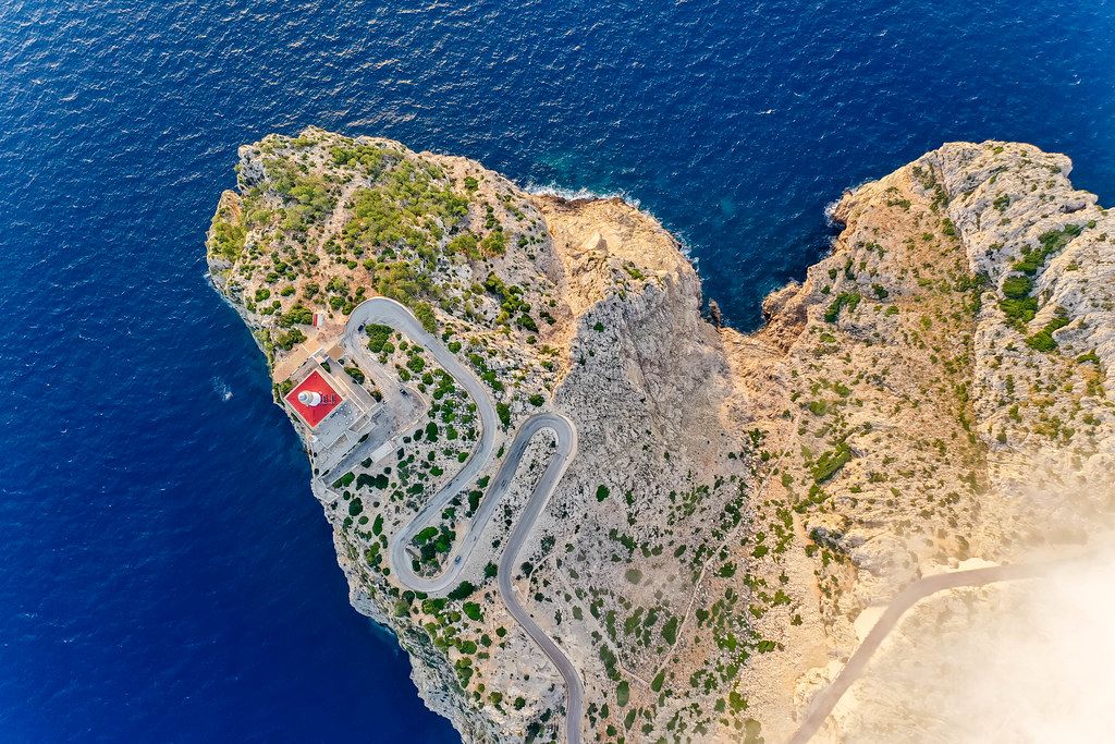
Drone view of Cap de Formentor cliffs and lighthouse von Marco Verch unter Creative Commons 2.0
Dieses Bild kann bei sichtbarer Nennung von Urheber und Quelle kostenlos verwendet werden. Anfrage für eine Nutzung außerhalb der Lizenz.
Das Foto zeigt eine spektakuläre Luftaufnahme einer felsigen Küstenlandschaft mit einem gewundenen Straßenverlauf. Die kräftige blaue Farbe des Meeres bildet einen starken Kontrast zu den gelben und braunen Felsklippen, die von vereinzelter Vegetation durchsetzt sind. Die Draufsicht vermittelt einen atemberaubenden Blick auf diese malerische Naturkulisse.
Die hochwertige Bildqualität und die einzigartige Perspektive machen dieses Foto zu einem idealen Gestaltungselement für verschiedene Einsatzbereiche wie Blogs, Newsletter, Social-Media-Beiträge oder Werbematerialien. Das Bild besticht durch seine lebendige Farbpalette und die gelungene Komposition, die den Betrachter in die Szenerie eintauchen lässt.
Als kostenloses Stockfoto in hoher Auflösung und unter einer Creative-Commons-Lizenz kann dieses Foto frei und ohne Einschränkungen für private und kommerzielle Zwecke genutzt werden. Es bietet eine hervorragende Möglichkeit, Urlaubsregionen, Reiseziele oder Naturerlebnisse stimmungsvoll darzustellen.
Informationen zum Bild und Creative Commons Lizenz
| Original-Titel | Overhead drone shot: the steep cliffs, rugged landscape and lighthouse of Cap de Formentor |
| Fotograf | Marco Verch |
| Veröffentlicht | 11.08.2020 |
| Lizenz | Creative Commons 2.0 |
| Aufrufe | 1 |
| Downloads | 0 |